Orienting tools
Really see the world

It’s not enough to learn about the world — the goal is to see it.
We include three (totally optional) tools to orient kids to the world and help them feel that they belong in the Universe: maps, timelines, and a “size line”.
Maps, maps, maps
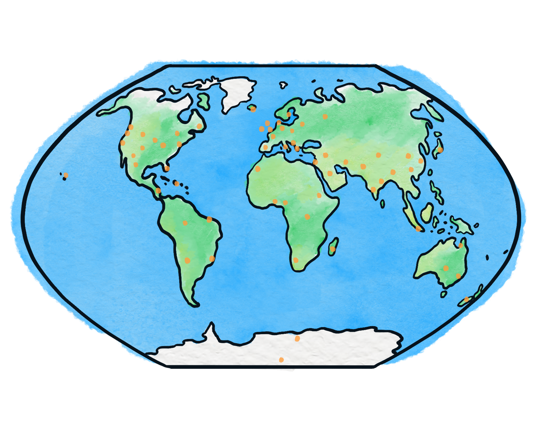
Too often, science is taught like it’s separate from the world — like it’s just facts and abstract concepts.
But science is the world. Even those abstract concepts came from somewhere!
Science is WEIRD lessons have always included a lot of geography. In “Water is Weird” (our second topic), we help every kid learn it and keep it learned.
This is cumulative. Your kid’s knowledge will grow like a snowball rolling downhill… for all six years. They’ll intuitively know the positions of places like —
France?
The Indian Ocean?
The Negev Desert?
The Yangtze River?
The Ural Mountains?
This is their world: kids should know where things are.
How do we do it?
We make customized maps on Seterra.com.
We start basic. By the end of the first year, your kid will know the locations of all the continents, all the oceans, all the biggest rivers and cities and nations we’ve mentioned…
And by the end of the six years, they’ll know — well, a lot! Deserts, major cities, ecological zones… and a bunch of places that are just really cool: what part of the world has —
the strongest wind?
the biggest snails?
the deadliest bacteria?
Is that it? Just “spots on maps”?
There’s more.
We combine this with “self-orientation” challenges. Wherever they go, they can know —
what direction is home?
what direction is Antartica?
where’s the Moon (and which way is it going)?
where’s the Milky Way?
The goal, overall, is to help kids feel their place in the world.
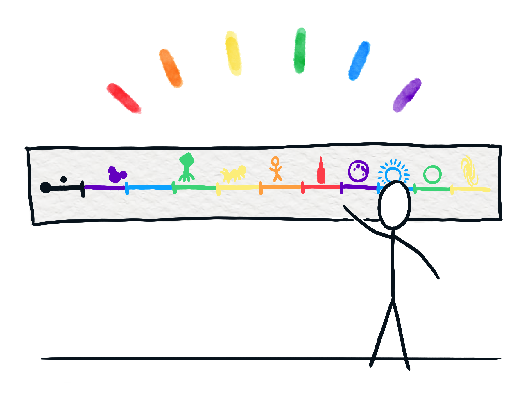
Big history timelines

Here’s something that science classes too often miss: the Big Bang isn’t over! Everything we study is part of the one event that we call “the Universe”. A single set of timelines can help bring it all together.
Lots of hungry-minded families have timelines on their walls. But the ones we’ll help you make are a little different: multiple timelines at multiple scales.
We help you (if you choose) make timelines for…
modern history (1 foot ≈ 100 years)
civilizational history (1 foot ≈ 1000 years)
the story of life (1 foot ≈ 100,000,000 years)
the story of the whole Universe (1 foot ≈ 1 billion years)
Because science, done well, becomes Big History.
What do we do?
Each time we learn about something important in the distant past —
the first fish!
the extinction of the dinosaurs!
the dawn of humans!
— you’ll be able to print out a cute little picture and place it on the timeline. And each time we learn about a scientific discovery —
Galileo and the Solar System!
Newton and gravity!
Bohr and the atom!
— you’ll be able to do that, too!
What’s the goal?
The goal of all this is to help your kid connect what they learn in our class with everything else they learn.
Even more, it’s to help them see the big story of life, the Universe, and Everything.
Size lines
When it comes to size, too many people only have two categories: “big” and “small”. Alas, those words hide what’s really going on —
an amoeba is closer to your size
than it is to an atom
a T-rex is closer to your size
than it is to the Statue of Liberty
We want to help kids understand the world intuitively, and to do that, they need many scales of size.
We’ll help you (if you choose) make a gorgeous, hand-colored version of all these scales, put onto a single line. (Thanks to Cary Huang and the website The Scale of the Universe 2 for the inspiration for this!)
How do we use this?
Throughout all six years, every time we learn about something new —
neutrons!
neutron stars!
the rabies virus!
— you’ll get to print out a cute little cartoon, color it, and tape it to the proper part of the size line.
And in class, we’ll imagine we’re shrinking down (or swelling up) to the each of these scales, so we can better see what we’re studying —
What does a snail look like when you’re in a millimeter tall?
What does the sky feel like when you’re a kilometer tall?
The goal in this, of course, is just to help kids see the world as it really is, using their imagination.
But why?
Lots of smart people have abstract knowledge — they can tell you where Africa is on a map, or when Galileo lived, or how many picometers wide an atom is.
But very few people are able to connect them. Very few people can picture them. Very few people walk around with the Universe in their heads.
But being able to really see the world is what science is all about. It’s the birthright of everyone who lives in the 21st century.
These three orienting tools are Science is WEIRD’s way to help everybody do that.